Atacama Desert
Alabalti! says the sign. That is “welcome” in Cunza, a lost language of just 400 guttural words that was spoken in San Pedro de Atacama, Chile, until the 16th century. Then the conquistadors of Pedro de Valdivia forced locals to switch to Spanish, under penalty of having their tongues cut out. Yet the Atacameños, or Licanantay—meaning “the inhabitants of the land” in Cunza—still use the word alabalti, especially during festivals, to invite outsiders into their homes. A fine sign of hospitality in one of the least populated and climatically harshest regions imaginable: the Atacama Desert, the oldest and driest in the world, with some areas of desierto absoluto, where, within living memory, rain has never fallen.
What to See in the Atacama Desert
Valle de la Luna
Atacama has recently made headlines for the gigantic dumps of textile waste and discarded jeans that, once abandoned by consumers around the world, arrive by ship at the free port of Iquique and are then dumped among the dunes of Alto Hospicio, in the northern part of the country. Atacama is also a mirror of the planet’s relentless activity: the tectonic movements caused by the Nazca Plate sliding beneath the Pacific led to the formation of the Andes and the adjacent plateau, dotted with volcanoes, thermal waters and geysers.
To grasp this, all it takes is a trek in the Cordillera de la Sal, the result of tectonic activity. Its fiery red and dazzling white core is the Valle de la Luna, so named for its extrateravagal appearance by Belgian Jesuit Gustave Le Paige (1903–198), a distinguished archaeologist who in the 1950s discovered several shaman mummies buried here with objects used for consuming psychotropic substances, now preserved in a small museum dedicated to him in San Pedro.
The valley is an authentic display by Mother Nature—or rather by Pacha Mama, the supreme female deity of the Inca pantheon—because here too, as throughout western South America, the Incas laid out their communication routes and left signs of their culture. Golden-yellow hills eroded by the wind rise in parallel ripples from the flat bed of a dried-up lake encrusted with salt. The trail winds upward, offering views worthy of the name of the ridge, Sarapana, the Inca deity of physical and inner healing. Along the crest, one discovers a great wave of ultra-fine sand that at sunset takes on an unreal chocolate hue.

Valle de la Muerte
Parallel to the Valle de la Luna, the Valle de la Muerte—so named, according to some, because locals misunderstood the word Mars (the planet) as muerte—with its narrow, distinctly “Martian” canyons, has become a place of recreation.
Sandboarding enthusiasts surf down the blazing dunes, while those who prefer more traditional sports go horseback trekking. Robin Barraza, with the bearing of a huaso (the Chilean cowboy), has devoted his life to this activity. “For years I ran the family hacienda in central Chile, but it was a stressful job,” he says, adjusting his chupalla, a wide-brimmed hat. “Here, instead, I’m in contact with my horses and with the people for whom I organize multi-day tours, with dinners under the stars featuring grilled meat. It’s a life lived at more natural rhythms. It teaches you to take your time.” And time here flows slowly. Confirmation even comes from an old but still relevant issue of National Geographic about the Chilean desert, which Robin proudly shows, featuring him at center page as he rides through a canyon.
San Pedro de Atacama
For these desert caballeros, San Pedro de Atacama, at 2,400 meters above sea level, is an oasis made green by the San Pedro River, one of the few perennial rivers. In the village center, pepper trees shade the Plaza de Armas, while all around, houses have walls made of adobe mixed with ichu (stipa), the Andean grass on which llamas feed.
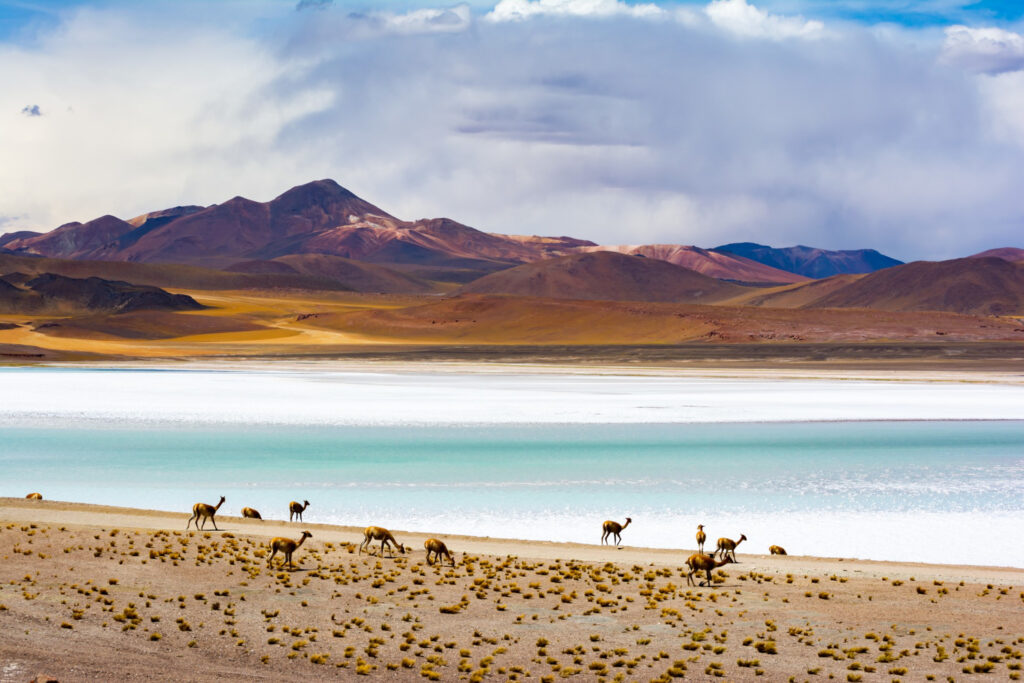
Even today, the place gives the impression of a frontier town, an outpost for the Chilean Puna, a plateau above 3,500 meters frequented only by vicuñas, pink flamingos and foxes. The narrow, sand-covered streets—claimed, it seems, by the desert itself—are crowded with modern-day gringos from some undefined elsewhere. Everyone who comes here is seeking adventure, each according to their own physical capabilities.
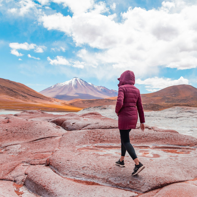
The local shop sells disposable oxygen canisters to those who wish to climb “Grandfather,” the Licancabur volcano, which dominates the landscape at 5,920 meters, its summit dusted with white ash: a presence worthy of respect, so much so that locals always greet it, considering it an intermediary between sky and earth, divine and human. For those seeking a less demanding approach to the desert, there are excursions offered by the many agencies along Calle Caracoles, the main street, competing for space with small restaurants.
Evenings stretch late around fires, with rounds of patasca—a meat and corn stew—charqui, dried llama or alpaca meat, and chicha, the popular corn beer. Shops offer, without distinction, technical trekking clothing, alpaca wool sweaters—very useful when the sun sets and temperatures plummet—and copper handicrafts. “I was drawn here by pre-Columbian history, minerals and the cosmopolitan atmosphere,” says Bernardo Aravena, an artist from Santiago who, together with Atacameño Victor Artiñano, opened the Yatiri shop on Caracoles Street.
“We exhibit jewelry and sculptures by various artists who work with hard stones and Atacama minerals. We also have a project with the Chilean Ministry of Culture to take ancient local masks and silver and copper sculptures throughout the country, as well as into Argentina and Peru.” This mineral—of which Chile is among the world’s top producers—is extracted a hundred kilometers further north at the gigantic Chuquicamata mine, near Calama, a town that was once a tambo, or waystation, along the 40,000 kilometers of roads traced by the Incas, and today serves as a dormitory town for those who work underground.
The desert, while so stingy with animal and plant life, is instead prodigal with minerals: in addition to copper, there is saltpeter, which in the 19th century sparked a war with Peru and Bolivia for control of the deposits, followed by plutonium, silver and lithium. Waters from Andean glaciers created lagoons and peatlands in Neolithic times, but later prehistoric climatic changes caused them to evaporate, releasing minerals and salts.
In the bowels of this extraordinary land, the Polish geologist Ignacio Domeyko Ancuta, to whom an entire mountain range is dedicated, discovered silver and rock salt mines in the 19th century. Of the intense activity of Victoria’s Mine—closed in 1996 when the area became a protected park—only a few shacks and tunnel entrances remain, among extruded lava sculpted by the wind and crystals of gypsum and salt glinting beneath a powerful sun that slows everything down, even the passing of days.
Rainbow Valley and the Yerbas Buenas Petroglyphs
Indeed, traveling through vast, nuanced landscapes as if painted by a watercolorist, with rosy volcanoes on the horizon and pale salt flats wavering like mirages, time seems suspended. The track climbs to 3,000 meters toward Rainbow Valley, following the Salado River to hills with green, white, yellow and black concretions that minerals have painted like a rainbow on red clay.
On foot, paths wind between magmatic outcrops of sinuous or soaring forms, standing out against the pure blue of the sky. In the surrounding grasslands appear linderos, stone markers that have always indicated the best pastures to llama herders; larger ones, the apacheta, placed at the crossroads of Inca roads, are true altars where, even today at New Year, offerings are made to Pacha Mama: chewed coca leaves, beer, locks of hair, old garments.
It is hardly surprising, then, that shamans here continue to make their knowledge available, healing people with ancient natural medicine made from Puna herbs: digestive rica-rica, which together with pingo-pingo becomes a kind of natural Viagra; jalleta, a moss used as an antidiabetic and, when burned, to keep embers alive; and cebil seeds, purgative but also hallucinogenic during ceremonies.
Equally evocative, on the return journey, are the Yerbas Buenas petroglyphs, carved by scratching soft volcanic rock over different eras: shamans and foxes, llamas and pumas, engraved in prehistoric times to placate the gods before hunting guanacos, and in pre-Columbian times to seek protection for merchant caravans.
The Rocks of Atacama
The rocks of Atacama thus tell the story of a people. They recount the age of hunter-gatherers who lived here (7000 BC); the time when people began crossing vicuñas and guanacos to obtain llamas and alpacas, raising them for transport and wool, becoming farmers and forming the first stable communities (4000 BC); and when, from 1000 BC, people lived in caves on a bright red hill at Pukará de Quitor, later building granaries and wooden-roofed houses until, in the 12th century, they erected cyclopean walls to defend themselves against aggressive Aymara neighbors.
Climbing the path to the hilltop, one passes through 42 ayllu, true neighborhoods where social groups organized into guilds lived: herders, farmers, potters. “Then, in the 16th century, a detachment of Spaniards commanded by Francisco de Aguirre arrived at Quitor: they were repelled, but later returned in force and conquered the fortress,” recounts Barbara Aldunce, who traded a managerial life in Santiago for a passion for the history and geology of this region.
“To survive, the Atacameños built churches and raised crosses—square and colorful like the Inca chakana—while in iconography Jesus Christ was placed to the side of the Virgin Mary, the central female figure who in reality symbolized Pacha Mama.” Even today, to warm Mother Earth at her awakening in August, elders burn coca leaves in holes dug into the ground. And the air around San Pedro fills with smoke and expectation.
Salar de Atacama, the Oasis of Pink Flamingos
Gazing at panoramas that in the dry atmosphere seem infinite—hundreds of kilometers crossed in a single glance—one marvels at the bond humans have maintained for centuries with their splendid and wild land. Such is the Salar de Atacama, a dry lake covering three thousand square kilometers, interrupted only by turquoise lagoons like eyes of sky, where it is fun to bathe, floating in water dense with magnesium and boron salts (400 milligrams per liter).
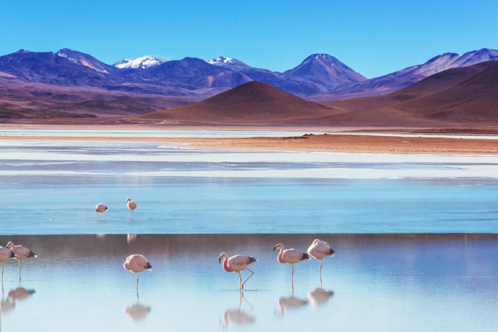
Against the white expanse stands out the pink blur of Andean, Chilean and James’s flamingos, which in Laguna Chaxa perform courtship dances toward the horizon closed by the Lascar volcano, as if to appease a turbulent deity. This land becomes literally boiling higher up, at 4,300 meters on the Tatio plateau, where glacial waters penetrating magmatic subsoil are blasted skyward in geysers. It is one of the largest geothermal fields in the world, in curious contrast to the truly freezing dawn temperatures (between –15 and –20°C).
Walking among fumaroles and golden patches of copper and sulfides, uncertain silhouettes in the steam plumes, one truly experiences the power of Pacha Mama: a formidable deity capable of making the volcano Tata (grandfather) weep—tata io, later becoming Tatio, meaning “the old man’s lament”—after causing it to collapse with earthquakes.
On the surrounding Puna, the Putana River, flowing from the volcano of the same name, forms lakes and marshes frequented only by birds, abandoned and feral llamas left behind after the death of their former owners, and a few Atacameños. It is said they know where to find gold and pass the location of the mine from father to son. But they cannot be greedy and take too much: it contains a high percentage of mercury, and touching it with bare hands would make them ill. Pacha Mama, it seems, knows many ways to teach moderation to her children.
Stargazing and Radio Telescopes
The extreme aridity and altitude make the Atacama Desert one of the wildest places on Earth, but also one of the brightest and most favorable for stargazing. Not by chance, this is where ALMA—the Atacama Large Millimeter/submillimeter Array—was installed. Operated by the European Space Agency (ESA) and other international partners, it is the most advanced radio telescope system for observing light from the coldest objects in the universe.
Located on the Llano de Chajnantor, a plateau at five thousand meters above sea level characterized by an almost total lack of humidity (just 0.2 percent), it consists of 66 high-precision antennas designed to capture dust and molecular gas from deep space—the building blocks of stars, planetary systems and life itself—while also identifying galaxies at the edge of the observable universe, visible as they were ten billion years ago. Chajnantor in Cunza means “place of departure”: an evocative and auspicious name indeed.
What You Need to Know About the Atacama Desert
Climate
The Atacama Desert has the most arid and dry climate in the world: some areas, at least since meteorological records have been kept, have never seen rain. Rainfall is rare even along the coast, despite persistent fog. In San Pedro, skies are clear throughout the year. The hot, dry season runs from early November to mid-March, with temperatures between 1°C and 25°C; in the cool, dry season, from late May to mid-August, temperatures range from –2°C to 21°C.
When to Go
Every season is suitable. The clearest period of the year begins around mid-March and lasts for eight months. The sunniest month is September (with sunshine 90 percent of the time); the cloudiest is January (overcast 31 percent of the time); and the coldest is July, with minimum temperatures sometimes below freezing.
How to Get to the Atacama Desert
From Santiago de Chile flight to El Loa Airport in Calama, with round-trip fares starting at $150. San Pedro de Atacama can then be reached via shared van service or private driver (1h).